
- GLOF?
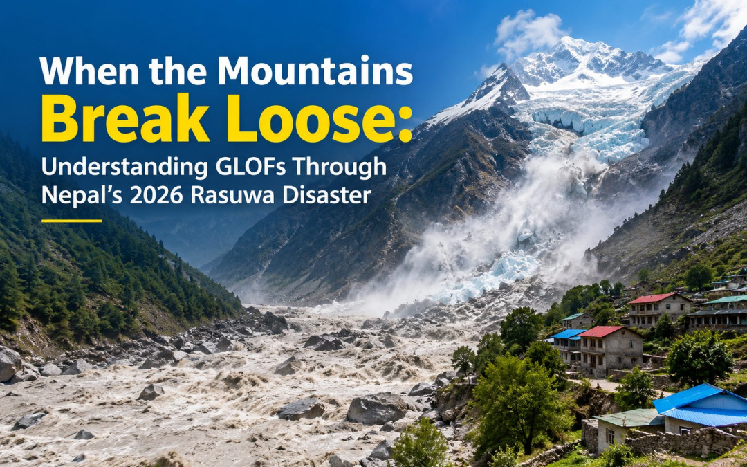
A Glacial Lake Outburst Flood (GLOF) occurs when a lake formed by melting glacier ice — often dammed by unstable moraine, ice, or a temporary debris blockage — releases its impounded water suddenly and catastrophically. The result is a wall of water, ice, and sediment that can travel tens to hundreds of kilometres downstream within minutes to hours, arriving with far greater speed and destructive force than an ordinary river flood.
GLOFs are a defining hazard of high-mountain “cryosphere” regions — the Himalaya, Andes, and Alps — wherever retreating glaciers leave behind meltwater ponds held back by unstable natural dams. Closely related but mechanistically distinct is the glacier collapse flood (or ice-rock avalanche-triggered flood), where a chunk of glacier or a rock-ice mass fails outright, either forming a new temporary lake that then bursts, or directly generating a debris flow without a pre-existing lake at all. In practice, especially in the first hours after an event, it can be genuinely difficult for scientists to tell the two apart — as happened with the August 2026 Nepal disaster discussed below, where “GLOF,” “glacier collapse,” and “ice avalanche-triggered flood” were all used by different agencies before satellite and seismic data narrowed the picture down.
- Disaster Risk It Poses
GLOFs are driven by a chain of physical processes: rising temperatures accelerate glacier melt and retreat, creating and enlarging proglacial lakes; the moraine or ice dams holding these lakes back are inherently unstable (unconsolidated debris, buried ice, steep faces); and triggers such as avalanches, rockfalls, heavy rainfall, seismic tremors, or simple overfilling can breach the dam without warning.
What makes GLOFs disproportionately dangerous as a disaster risk is a combination of:
- Extreme velocity and short lead time — flows can exceed 150–200 km/h in the initial descent through steep terrain, leaving communities minutes rather than hours to react.
- Long reach — a single event can travel over 100 km, affecting areas that never perceived themselves as “glacier-adjacent.”
- Cascading hazard chains — an earthquake or avalanche triggers a landslide, which dams a river, which then fails; each link changes the hazard’s character mid-event.
- Transboundary complexity — Himalayan glaciers and lakes often sit in one country while downstream communities and infrastructure sit in another, complicating monitoring and warning.
- Increasing frequency under climate change — as glaciers retreat faster, more lakes form, more become large enough to be dangerous, and destabilising triggers (heatwaves, erratic rainfall, permafrost thaw) become more common.
- The Nepal Disaster: August 2026
On the morning of 26 August 2026, a massive rock-ice mass collapsed near Langtang Lirung in Nepal’s Langtang National Park, close to the Nepal–China (Tibet) border. The collapse — associated with a seismic signal equivalent to a magnitude 5.2 tremor — blocked a tributary of the Bhote Koshi River on the Tibetan side, and when that temporary blockage failed, it unleashed a torrent of water, ice, and debris down the Bhote Koshi into Nepal’s Trishuli River system. Fig 1 shows the disaster location.
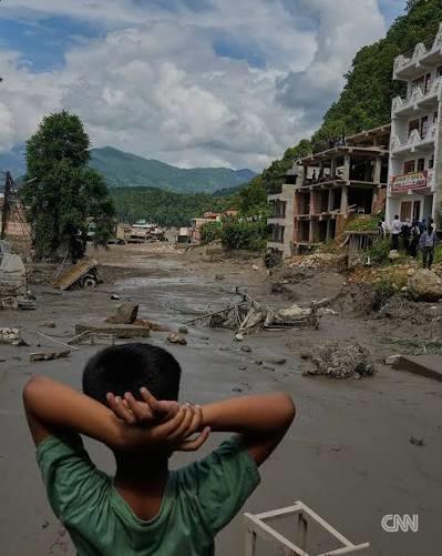
The flood wave tore through Rasuwa district — hitting Timure, Rasuwagadhi, and Syabrubesi hardest — before racing roughly 70+ km downstream through Nuwakot, Dhading, and beyond, at one point raising Trishuli River water levels by around 9 metres in just 30 minutes. It destroyed the Gyirong Port complex, a major China–Nepal trade and tourism gateway, and swept debris and even bodies as far as 240 km away into India. Scientists remain divided on whether to formally classify it as a GLOF, a glacier-collapse flood, or an avalanche-triggered outburst — but functionally, for the communities below, it behaved exactly like one of the most destructive GLOF events the region has seen.
This was not an isolated event. The same river corridor experienced a confirmed GLOF just 13 months earlier: in July 2025, a supraglacial lake outburst on the Tibetan side swept away the Sino-Nepal Friendship Bridge at Rasuwagadhi, killing at least eight people.
A separate, smaller GLOF struck Tilgau village in Humla in May 2025. The recurrence on the same corridor is itself a significant signal, discussed further in Section

Feeble compared to Nature
- Impact on Communities
The human toll has been severe and is still being finalised:
- Deaths and missing: Nepali authorities have confirmed several hundred deaths with figures still rising through the response window, alongside close to two thousand people reported missing in Nepal alone, plus additional casualties and missing persons across the border in Tibet.
- Foreign nationals: A large share of the missing — reportedly hundreds — are foreign trekkers, traders, and workers, reflecting the corridor’s role as a major tourism and cross-border trade route.
- Children: UNICEF estimated roughly 17,000 children impacted, with homes, classrooms, and medical facilities destroyed in front of them.
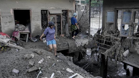
- Displacement and livelihoods: Entire settlements were buried or swept away, leaving survivors without homes, possessions, or means of livelihood — particularly acute for communities dependent on trans-Himalayan trade, tourism, and hydropower employment.
- Health risks: Damage to water and sanitation infrastructure has raised the risk of waterborne disease outbreaks among displaced populations, compounding the immediate injury toll (at least several hundred injured). The most affected districts — Rasuwa, Nuwakot, and Dhading — are also among Nepal’s more remote and infrastructure-poor regions, meaning the disaster hit communities that already had comparatively thin margins for absorbing shocks.
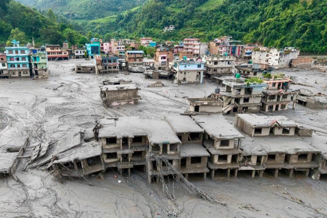
Devastation of infrastructure (Source: The Hindu)
Total loss of belongings (Source: The Hindu)
- Reading the Disaster Through H × V ÷ C = R
The standard disaster-risk formulation — Risk = (Hazard × Vulnerability) ÷ Capacity — offers a clean lens on why this event became so catastrophic.
Hazard (H): A high-magnitude, high-velocity cascading hazard — glacier/rock-ice collapse → debris damming → sudden dam failure — occurring in extremely steep terrain that amplified flow speed and destructive energy far beyond a typical flood.
Vulnerability (V): Settlements, bridges, roads, and hydropower infrastructure concentrated directly within narrow, high-energy river corridors with essentially no setback distance; a monitoring network configured for monsoon and perennial flood patterns rather than glacial/avalanche-triggered outbursts; foreign nationals and seasonal workers unfamiliar with local evacuation routes; and a border geography that split hazard-generation (Tibet) from most of the exposed population (Nepal).
Capacity (C): Nepal and China had jointly maintained an early warning system since 2016, and the Nepali Army, Red Cross, and government mobilised rescue and relief rapidly once the flood struck. But structural capacity gaps — aging sensors that had fallen into disrepair, no real-time transboundary data-sharing mechanism, and upstream gauges that were themselves destroyed before they could transmit an alert —meant detection-to-warning-to-evacuation capacity could not keep pace with a hazard moving at nearly 200 km/h.
The product of a severe hazard and high vulnerability, divided by a capacity that was present in principle but critically under-matched to this specific hazard type, is exactly the high-risk, high-consequence outcome that materialised.
- Estimated Losses
Based on reporting through late August 2026, cumulative damage includes:
- Human lives: Several hundred confirmed deaths in Nepal (with the toll rising through the response period) plus additional fatalities in Tibet; close to 2,000 people reported missing in Nepal and several hundred more across the border; at least 466 injured.
- Housing and settlements: Entire village cores in Timure and Syabrubesi buried or swept away; thousands of families displaced into temporary shelters.
- Infrastructure: At least 32 motorable bridges destroyed; roughly 40 km of paved road (including the entire Betrawati–Rasuwagadhi highway) washed away; the Gyirong Port border complex completely destroyed.
- Energy sector: 14 hydropower and solar projects (combined capacity ≈ 748 MW) affected, with six major hydropower and transmission facilities damaged, disrupting regional power supply.
- Education and health: 18 schools completely destroyed and roughly 20 more damaged; medica facilities damaged in the affected districts.
- Agriculture and livestock: Localised destruction of irrigation infrastructure, farmland, and livestock in the flood path, compounding the loss of livelihoods (this component of the damage assessment is still being consolidated by Nepali authorities).
- Trade: Halted cross-border commerce along Nepal’s principal northern trade route with China. For scale, a comparable but rainfall-driven disaster — the 2024 Nepal floods — caused 224+ deaths and roughly Rs 17 billion+ in estimated property damage; given the scope of infrastructure and cross-border trade losses in 2026, the eventual damage estimate for this event is likely to be substantially higher once consolidated.
- Why the Damage Was So Severe
Several compounding factors explain the scale of destruction:
- Extreme flow velocity: The flood wave reportedly descended the first 22 km at an average speed of about 193 km/h — under 7 minutes to cover nearly 14 miles — leaving essentially no time for manual warning or evacuation near the source.
- Concentration of critical infrastructure in the river corridor: Bridges, the highway, and hydropower plants were built directly along the narrow Trishuli/Bhote Koshi valley, the path of least resistance for both transport planning and flood energy a like.
- A monitoring system tuned for the wrong hazard: Sensors were optimised to detect monsoon and perennial river floods, not a sudden glacier-collapse-triggered outburst — a fundamentally different hydrograph shape and speed.
- Loss of the sensors themselves: Upstream monitoring stations in Nepal were destroyed by the flood before they could transmit an alert, effectively decapitating the warning chain at the moment it was most needed.
- A recognised transboundary “blind spot”: Experts have noted the area straddling the Nepal–Tibet border received comparatively little glaciological attention relative to other, more closely studied Himalayan lakes — despite the July 2025 event on the same river system.
- Population density and seasonal exposure: August falls within peak trekking and cross-border trade season, meaning higher-than-average numbers of transient people (foreign trekkers, traders, seasonal workers) were present in the corridor.
- What Went Wrong
Distilling the above into direct failure points:
- Instrumentation mismatch: Detection infrastructure was designed around a different flood typology, so it could not “see” this hazard early enough.
- Infrastructure decay: Automated sirens and sensors installed in 2016 had reportedly fallen into disrepair by 2026, quietly eroding a system officials still believed was functional.
- No real-time cross-border data pipeline: Despite Nepal’s stated commitment after the 2025 event to strengthen coordination with China, there was apparently no operational mechanism for rapid glacial-hazard information sharing at the time of the 2026 event.
- Single point of failure in the sensor chain: Because upstream gauges were destroyed by the flood’s leading edge, the system had no redundancy — once the nearest sensors failed, the alert chain failed with them.
- Insufficient hazard-zoning enforcement: Bridges, roads, and power infrastructure remained concentrated in the highest-energy part of the valley, reflecting a broader regional pattern of building critical infrastructure without adequate hazard setbacks.
- Underinvestment in a known recurring risk: The July 2025 GLOF on the same river system was a clear precedent; it does not appear to have triggered the scale of monitoring investment the recurrence risk warranted.
- What Could Have Reduced the Damage
- Multi-hazard-aware, automated sensor networks — instruments and thresholds specifically calibrated to detect glacier collapse and outburst-type hydrographs, not just monsoon flood patterns, feeding directly and automatically into forecasting centres without manual bottlenecks.
- Redundant, decentralised warning channels — sirens, radio, and trained community task forces that do not depend solely on mobile networks or electricity, both of which routinely fail during the hazard itself.
- Formal, real-time transboundary data-sharing protocols between Nepal and China, so that a glacial event detected upstream in Tibet reaches Nepali forecasters within minutes, not after the fact.
- Expanded glacial lake and slope-instability inventories covering “blind spot” zones — not just the handful of lakes already flagged as high-risk — combined with satellite-based monitoring for newly forming, avalanche-dammed lakes.
- Hazard-informed infrastructure siting — setback distances for bridges, roads, and hydropower facilities from high-energy river corridors, or engineering hardening where relocation isn’t feasible.
- Community-based early warning drills so that even a short lead time translates into effective evacuation behaviour, rather than confusion.
- Sensor redundancy and hardening so that the failure of one upstream gauge does not sever the entire warning chain.
- Lingering Dangers
The immediate disaster has not resolved the underlying hazard:
- New unstable lakes: Two lakes have formed at the site of the glacial collapse and are being closely monitored by Nepali and Chinese authorities as a “high risk” of further outburst flooding— meaning a second wave of danger sits directly upstream of already-devastated communities.
- Continued monsoon rainfall: Additional rain forecast in the affected region raises the risk of further slope failure, secondary landslides, and complications for ongoing search-and-rescue operations.
- Downstream transboundary exposure: The Bhote Koshi feeds into the Trishuli and ultimately the Gandak river system, which flows into Bihar, India — meaning any future outburst carries risk far beyond Nepal’s borders.
- Long-term glacier destabilisation: Climate warming continues to destabilise Himalayan glaciers and permafrost, meaning this valley — and others like it — remain primed for repeat events.
- Public health risk: Damaged water and sanitation systems leave displaced populations vulnerable to disease outbreaks in the weeks following the flood.
- Economic and connectivity fragility: With the main highway, bridges, and a major border crossing destroyed, the region’s trade and mobility remain severely constrained, delaying both recovery and the ability to reach at-risk communities further upstream.
- What We Should Learn From This
- GLOFs and glacier-collapse floods are no longer rare, isolated events on this river system — they are recurring. Two major outburst-type floods on the same corridor within thirteen months (July 2025 and August 2026) point to a trend, not simple bad luck, consistent with the broader pattern of accelerating glacial retreat under climate change.
- Early warning systems must be hazard-specific and living, not static. A system built for monsoon floods will not detect a glacier collapse; a system installed in 2016 is only as good as its maintenance a decade later.
- Transboundary cooperation is not optional infrastructure — it is core infrastructure. In a basin where the hazard originates in one country and communities are exposed in another (and further downstream in a third), rapid, trusted, real-time data sharing has to be treated as seriously as the physical sensors themselves.
- Redundancy saves lives when speed is the enemy. With flood waves moving at nearly 200 km/h, single points of failure — one destroyed gauge, one down mobile tower — can collapse an entire warning chain exactly when it matters most.
- Development planning in high-mountain valleys needs to internalise cascading hazard risk, not just historical flood levels — critical infrastructure sited in the highest-energy part of a valley will eventually pay for that siting decision.
- Recovery planning must plan for the next event, not just this one. With new unstable lakes already identified upstream, reconstruction in the same corridor without addressing the residual hazard would simply reset the clock on the next disaster.
- This is a climate-adaptation problem as much as a disaster-response problem. The upstream driver — accelerating glacier retreat and destabilisation — will not reverse; the only controllable variables are monitoring, warning, cooperation, and where and how we choose to build.
Sources
- USGS — 2026 Nepal Debris Avalanche and Flash Flood
- Wikipedia — 2026 Nepal floods
- Wikipedia — 2025 Nepal floods
- Al Jazeera — Nepal-Tibet floods: what happened, what caused them and who is missing?
- CNN — Live coverage, 26–28 August 2026
- CARE — Nepal flash floods 2026: emergency response
- UNICEF USA — Deadly Flash Flooding Hits Nepal
- UN News — Shock and devastation remain, a day after Himalayan flood disaster
- The Conversation — Emergency warnings weren’t enough to save Nepal’s flood-ravaged villages
- Science Media Centre — Expert reaction to flash floods in Nepal-Tibet
- University of Reading — Nepal floods: expert comment
- Nepal News (English) — A pattern ignored: the Bhote Koshi disaster reveals Nepal’s transboundary blind spot